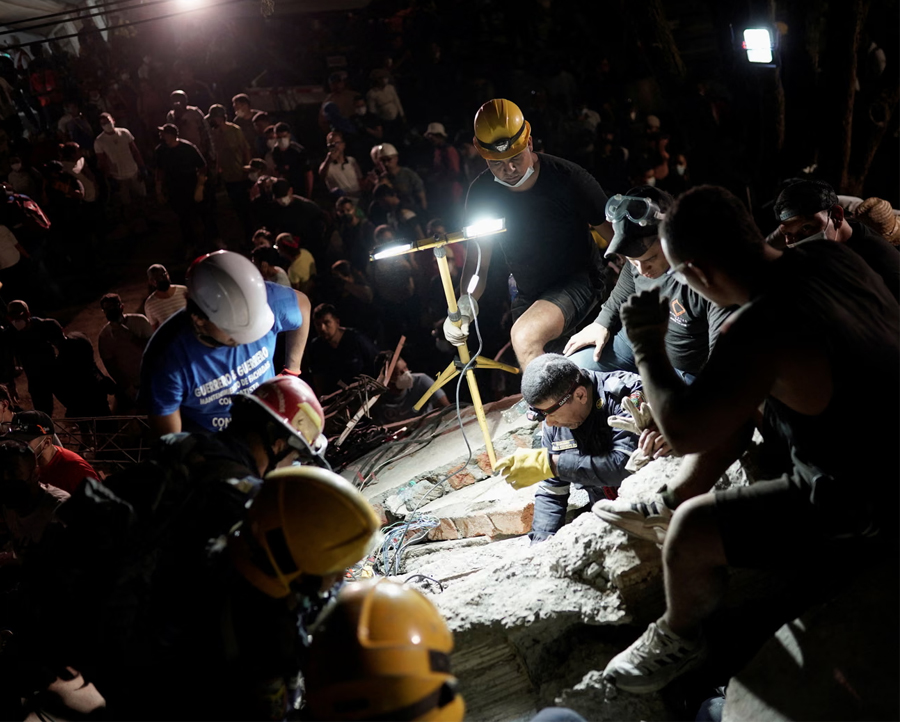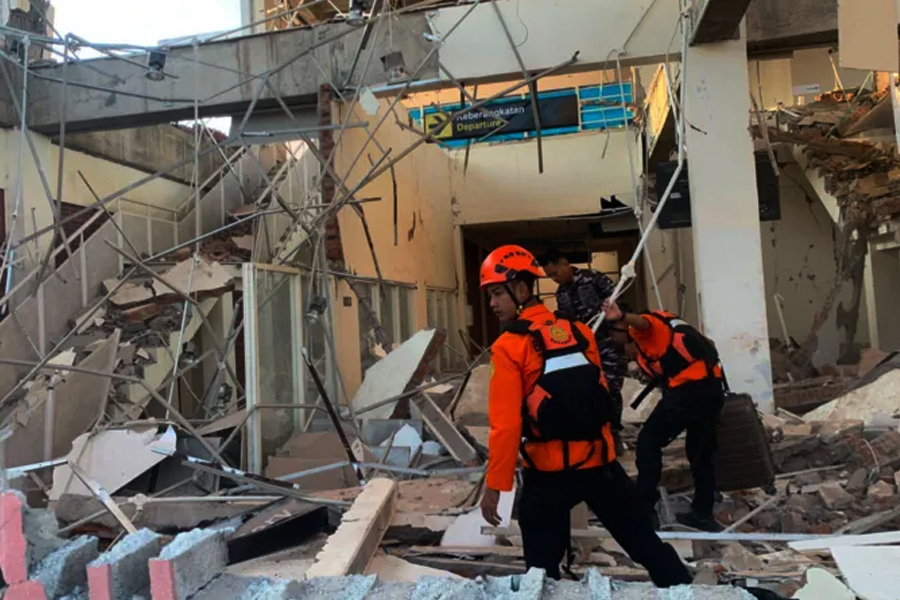
Rescuers search for victims after the earthquake in eastern Indonesia. A 7.7-magnitude quake struck the Flores region, killing at least five and causing widespread damage.
15 August 2026 | Flores, Indonesia — Updated 08:30 GMT
Flores, Indonesia – A powerful 7.7-magnitude quake struck eastern Indonesia early on Saturday, killing at least five people, causing widespread panic and collapsing buildings and homes in a region prone to deadly earthquakes.
Authorities had issued a tsunami warning, which has since been lifted, but there have been dozens of aftershocks, including one with a magnitude of 6.1. Tsunami waves of less than one metre (three feet) were recorded in several areas.
Indonesian geophysics agency BMKG recorded the first quake at 4.58 am local time at a depth of 15 km (9 miles) in Indonesia's Flores region.
Welcome to the latest world headlines — where natural disasters and human resilience collide in the Pacific Ring of Fire.
🌍 WORLD HEADLINES — KEY NUMBERS: 7.7-magnitude earthquake • 15km depth (shallow) • 5 confirmed dead • Dozens of aftershocks • 6.1 largest aftershock • 68km from Ende • 4:58 am local time • Tsunami warning issued then lifted • Buildings collapsed, port terminal destroyed • Ring of Fire region.
The governor of East Nusa Tenggara province, Emanuel Melkiades Laka Lena, told a press conference the five people died after rubble fell on them as they slept. The national disaster mitigation agency BNPB put the toll at one dead and four injured.
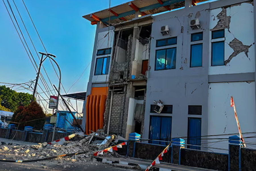
A damaged building in Ruteng, Manggarai, East Nusa Tenggara. The shallow earthquake caused widespread damage across the Flores region.
A video on Facebook, verified by Reuters as being at a port in Maumere, shows parts of a building collapsed into dust and rubble as people scream and run in the street. Maumere is the main town in Sikka Regency on Flores Island in the east of Indonesia's vast archipelago.
The epicentre of the quake was located off the north coast of Flores island, about 68km (42 miles) northwest of the coastal town of Ende, US and Indonesian authorities said.
🌍 INDONESIA EARTHQUAKE — KEY DETAILS
- Magnitude: 7.7-magnitude earthquake
- Depth: 15 km (shallow, more destructive)
- Location: Flores region, eastern Indonesia
- Deaths: At least five people killed
- Tsunami warning: Issued then lifted
- Aftershocks: Dozens recorded, including 6.1 magnitude
- Epicentre: 68km northwest of Ende, off north coast of Flores
- Time: 4:58 am local time
- Damage: Buildings collapsed, port terminal destroyed
- Ring of Fire: Indonesia prone to earthquakes and volcanic activity
Residents' Accounts
Residents in Nagekeo regency, the area closest to the epicentre, raced for higher ground immediately after the earthquake.
— Lukas Lotar, 31-year-old hospital customer service official
Nagekeo resident Yohanes Babo, 56, said he was at a market when the quake hit.
"The shaking was strong. Thankfully, we were already outside the house," he said.
"People were panicking, running here and there. We're evacuating for the time being … and trying to get to the hills," he said, adding: "My family is safe. No one was harmed."
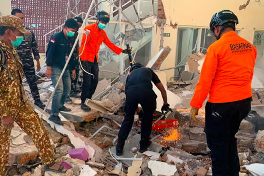
Rescuers working amid the rubble of a damaged building in Maumere. The port terminal in Maumere collapsed during the earthquake.
Tsunami Warning and Damage
Authorities issued a tsunami warning but later lifted it when Indonesia's meteorology, climatology and geophysics agency (BMKG) said monitoring showed no significant sea level changes that would pose a threat to coastal communities.
Images broadcast on Indonesian television showed hundreds of people in nearby Nagekeo regency evacuating the area surrounded by the rubble of damaged buildings.
The quake was felt across much of Flores island with initial reports indicating heavy damage.
Yohanna Embu, a resident of Sikka, a regency within East Nusa Tenggara province, said a number of buildings were damaged by the strong shaking and panicked people ran to higher ground.
— Yohanna Embu, Sikka resident
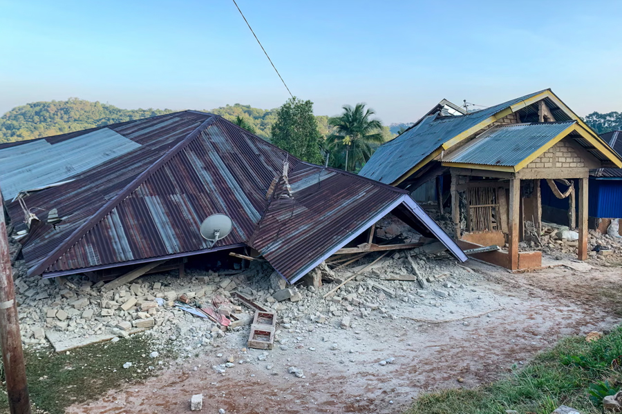
Houses were damaged by the 7.7-magnitude earthquake in Ruteng, Manggarai, East Nusa Tenggara, on 15 August 2026. The shallow quake caused widespread destruction.
Indonesia's Seismic Activity
Indonesia, home to more than 17,000 islands, is prone to earthquakes and volcanic activity because of its location on the "Ring of Fire", an arc of volcanoes and fault lines in the Pacific Basin.
🌍 INDONESIA QUAKE: THE NUMBERS THAT DEFINE THE DISASTER
💥 THE QUAKE AT A GLANCE
Magnitude
Depth (shallow)
Confirmed dead
From Ende
Local time
🗣️ KEY VOICES
Lukas Lotar (Resident):
"Suddenly it started to shake and I panicked. The jolt was big. I saw some walls were cracked."
Yohanes Babo (Resident):
"The shaking was strong. People were panicking, running here and there. We're evacuating."
Yohanna Embu (Resident):
"Many buildings here were damaged. I saw that the waiting room at the port terminal in Maumere had collapsed."
⚠️ DAMAGE REPORTED
🌊 AFTERSHOCKS & TSUNAMI
🌋 INDONESIA & THE RING OF FIRE
🌍 THE FINAL VERDICT: INDONESIA'S RING OF FIRE STRIKES AGAIN
✅ WHAT'S HAPPENING:
- 7.7-magnitude earthquake strikes Flores
- 5 confirmed dead, more feared
- Tsunami warning issued then lifted
- Dozens of aftershocks, including 6.1 magnitude
- Rescue operations underway
⚠️ THE CHALLENGES:
- Buildings collapsed across region
- Port terminal destroyed in Maumere
- Residents fleeing to higher ground
- Shallow quake at 15km (more destructive)
- Indonesia on Pacific "Ring of Fire"
- Search for survivors continues
A powerful 7.7-magnitude earthquake struck eastern Indonesia's Flores region early Saturday, killing at least five people and causing widespread damage. The shallow quake, at a depth of just 15km, triggered panic across the region, with residents fleeing to higher ground fearing a tsunami. Authorities issued and later lifted a tsunami warning after monitoring showed no significant sea level changes. Dozens of aftershocks, including one measuring 6.1 magnitude, have followed the initial quake. Images show collapsed buildings, including a port terminal in Maumere, as rescue workers search for victims. Indonesia, situated on the Pacific "Ring of Fire," is one of the world's most earthquake-prone nations.
— World Headlines Analysis
Stay updated with the latest world headlines, natural disaster coverage, and breaking news on our World News Page.